How to Read Your Astrocartography Map, Step by Step
A step by step walkthrough for reading your astrocartography map: what the lines are, which ones matter for a place, how close is close enough, and the order to look at things in.
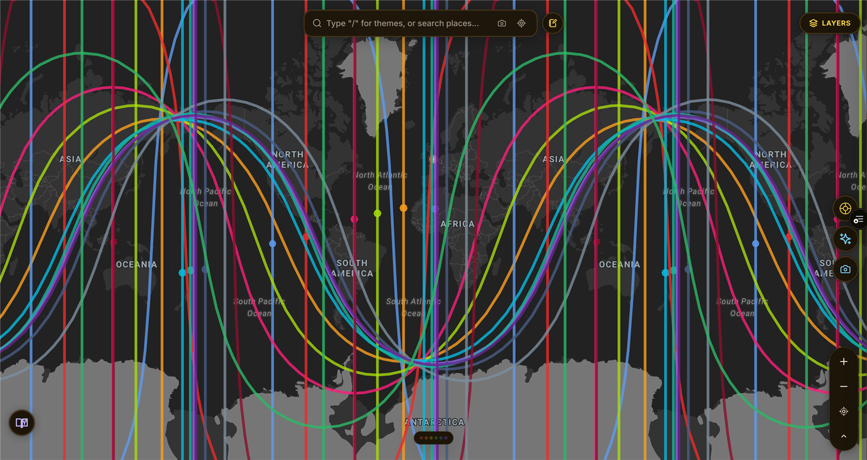
Every planet in one chart, drawn where it was rising, setting, overhead, or underfoot. This is the view most people meet first, and it is a lot at once.
The first time you see your own map it is overwhelming, and the usual advice makes it worse. People are told to look for their Jupiter line, so they scan the whole globe for one colour, find it crossing somewhere they have never been, and conclude they should move to Croatia.
There is an order to this that makes the map much smaller and much more useful. It starts with a place, not with a planet.
Read an astrocartography map in four passes: find the lines that actually run near your place, check how close they are, note which of the four angles each line sits on, and only then read what the combination means. Most misreadings come from skipping straight to meaning before checking distance.
Step 1: start from a place, not from a planet
Pick somewhere real. Where you live now is the best possible starting point, because you already know what it feels like and can check the map against your own experience rather than against a fantasy.
Click it. Everything else in this walkthrough happens in the context of that one place.
This inverts what most people do, and it matters. Scanning the globe for a planet you like produces a shopping list. Starting from a place you know produces a calibration: you find out whether this technique describes anything you recognise before you let it influence a decision.
Step 2: check distance before you read anything
This is the step people skip, and skipping it is the single most common way to misread a map.
A line has to be near you to be doing much. The influence falls off with distance, gradually rather than at a border, so a line running through your neighbourhood and the same line two hundred miles away are not the same claim. There is no universally agreed cutoff, and anyone who quotes you one as settled fact is overstating a working convention. A few degrees of longitude is the common range, which is roughly seventy miles per degree at mid latitudes.
ELA Map defaults to three degrees and gives you the distance in miles rather than making you estimate from a map scale.
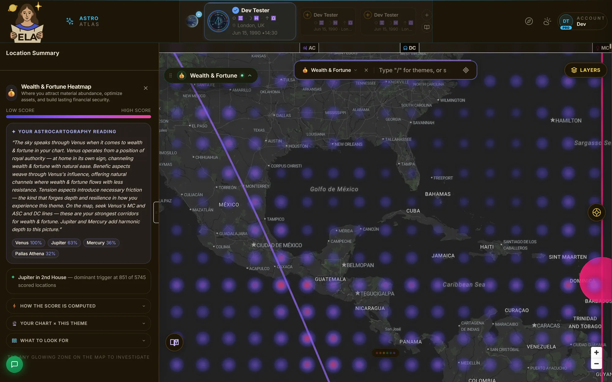
The panel does step two for you. Here it reports no lines within three degrees, names the eighteen that exist but are filtered out of view, and gives the relocated house placements underneath. "No lines nearby" is a real answer, and a common one.
If nothing is close, that is genuine information rather than a failure of the map. Most of the Earth is not on a line. A quiet place is quiet.
The circle and the shadow are the honest part
Two things on the ELA Map interface exist specifically so you do not have to do this step by eye, and both are worth understanding because they are where most maps quietly cheat.
The selection circle is the ring that appears when you click a place. It is not decoration and it is not a fixed size on your screen. It is drawn as a real radius on the globe, three degrees by default, which is the same orb the app uses to decide which lines count as near you. So the ring you are looking at is the question being asked. Anything inside it is in range, anything outside it is not, and the panel tells you the distance in miles rather than making you judge it against a scale bar. You can widen or narrow it, and the answer changes honestly when you do.
The line shadow is the soft corridor along each line. Most mapping tools draw a glow of a fixed pixel width, which means it silently lies: zoom out and the glow covers a thousand miles, zoom in and it covers ten, while looking identical. Ours is calibrated to a geographic corridor instead, so it holds the same distance on the ground at every zoom level. When you zoom in on a city and the shadow narrows on screen, that is the map staying truthful rather than the influence changing.
It sounds like a small rendering choice. It is the difference between a picture of an area of effect and an actual one, and once you have looked at a map that does it properly it is hard to trust one that does not.
You can turn the shadows on and off, and dial their strength, in the layer controls. Turning them on for a moment is the fastest way to see how wide these corridors really are, and it tends to be the point where the map stops feeling like lines on a picture and starts feeling like terrain.
Step 3: note the angle, not just the planet
Every line sits on one of four angles, and the angle changes the reading as much as the planet does.
| Angle | What it governs | The register |
|---|---|---|
| Rising | How you meet a place and how it meets you | Identity, first impressions, physical vitality |
| Setting | What arrives through other people | Partnership, collaboration, open conflict |
| Overhead | What a place makes visible about you | Career, reputation, public role |
| Underfoot | What a place does to your foundations | Home, roots, family, inner life |
The same planet on two different angles is two genuinely different readings. Venus overhead is not Venus underfoot. One tends toward being valued publicly for what you do, the other toward domestic ease and beauty at home. Treating "my Venus line" as a single thing throws away half the information you have.
For the planet-by-planet and angle-by-angle detail, that is the meaning of an astrocartography line.
Step 4: now read the meaning, and read it as terrain
Only now is it worth asking what the combination means.
Read the nearest lines first, in distance order. Read them as descriptions of what the place tends to amplify and ask of you, not as verdicts about whether you should be there.
This matters most with the lines that have bad reputations. A Saturn line is not a sentence. Saturn is boundaries and structure, which reads as hardship if you wanted the door open and as protection if you needed it shut. Published astrocartography readings include cases of exactly this, where a so-called difficult line turns out to be the thing that kept something valuable intact. Whether it lands as pressure or as scaffolding depends on what you are doing with your life this season, which the map does not know.
If you catch yourself deciding a city is bad because of a line's reputation, go back to step one and check the reading against a place you actually know.
Step 5: where two lines meet
Where two lines cross, the latitude of that intersection carries something of both planets, and it carries it along that whole latitude rather than only at the crossing point itself. ELA Map calls these crossings and labels them with both bodies and their angles, for example Jupiter DC × Pluto AC. The classical name for this is a paran, and what is a paran covers why the influence belongs to a latitude rather than a point.
They are worth noticing and they are a second-order effect. The classical literature is direct about this: crossing influences are not as strong as the primary planetary lines, but they do have a role. Read your near lines first, then look at what crosses.
A worked order, short version
- Click the place you already live.
- Read what falls within three degrees, nearest first, and note the miles.
- For each, note the angle before the planet.
- Read those as terrain and check them against your actual experience of that place.
- Only then look at somewhere you are curious about, and run the same four steps.
- Treat the practical facts of a place, work and visas and cost and climate and who is there, as at least as real as anything on the map.
That last one is not a disclaimer. It is part of reading well.
Where to go next
- The meaning of an astrocartography line for planet by planet and angle by angle.
- Astrocartography: the complete beginner's guide if you want the underlying technique explained from the start.
- Is astrocartography real? for what this technique can and cannot honestly claim.
- Best places to live by Human Design and astrocartography for applying all of this to an actual decision.
- Glossary for any term here you want defined plainly.
- A sample Location Context Report to see the full written version of steps one through four for one place.
Your own map is already drawn. Start with the place you are sitting in.
Place is personal.